What is working well
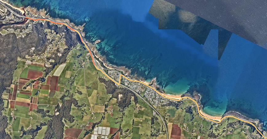
- Coastal Pathway as a strong regional spine
- Extensive urban footpath network in Ulverstone and Penguin
- High-quality foreshore and shared paths
- Strong walking activity in town centres
Central Coast already has strong coastal paths and valued walking areas, but the network does not work well for everyone.
The Draft Active Transport Strategy responds to known issues such as missing footpath links, uneven or ageing surfaces, accessibility and safety concerns, and limited dedicated cycling infrastructure.
The draft strategy has been informed by
Council maintains 170km of footpaths and is responsible for approximately 30.6km of Shared Coastal Pathway.
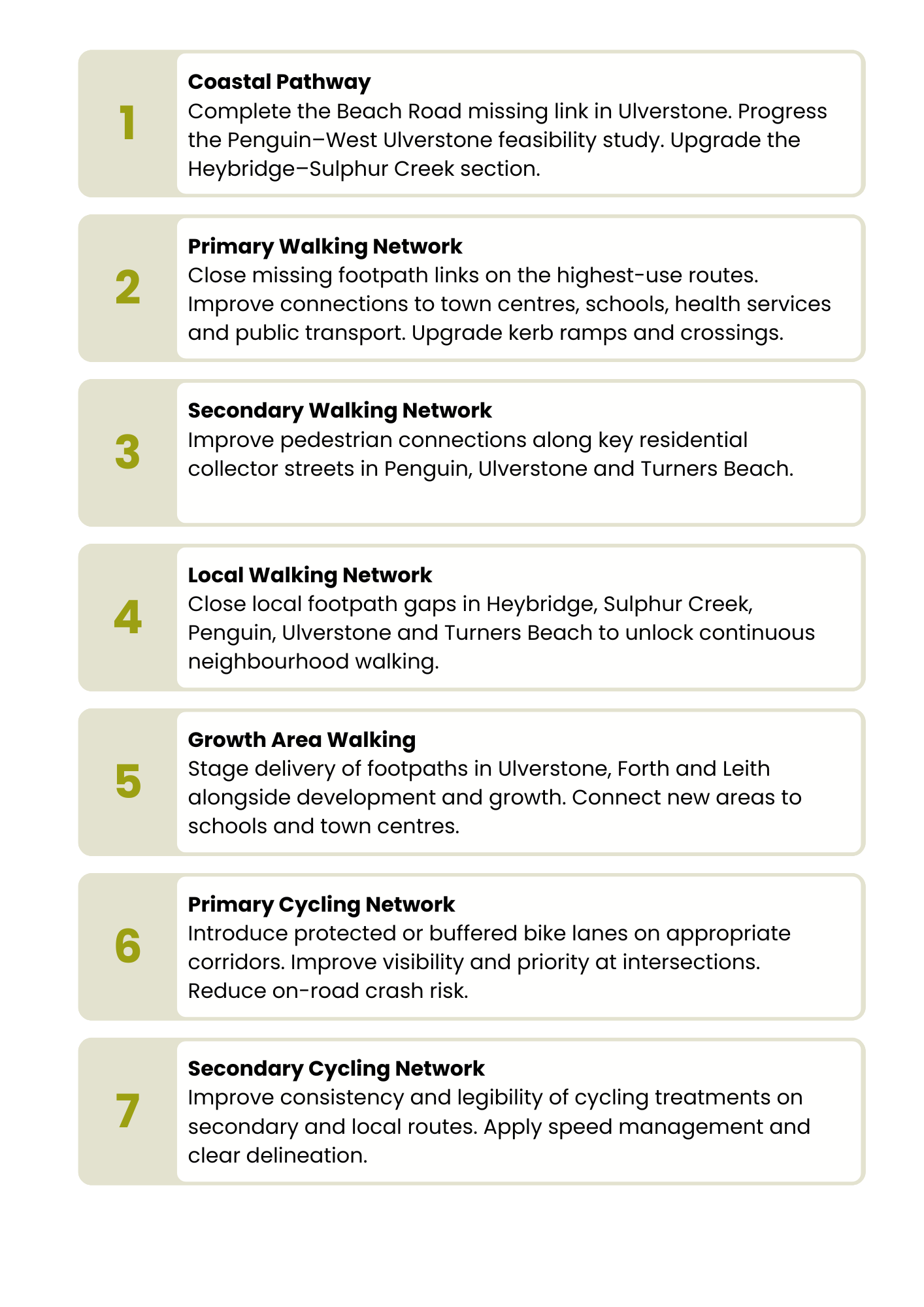
Council will focus first on improvements that provide the greatest safety, accessibility and connection benefits.
You can find the full Implementation Plan in the Draft Active Transport Strategy.
Active transport is essential to how people live, move and connect across the Central Coast.
Active transport provides a practical and strategic solution for current and future challenges facing Central Coast communities.
We want to create:
What we are asking for feedback on:
Overall direction, priorities and whether the Strategy reflects community needs.
Your feedback will directly shape this strategy
The survey is open until 11pm Sunday 31 May. Once we have received your responses, Council will consider whether changes are needed before the strategy is finalised.
Printed surveys and copies of the draft strategy are available from Council's Ulverstone Administration Centre (19 King Edwards St, Ulverstone) and the Penguin Service Centre (78 Main Rd, Penguin).
If you need help to take part, Council staff can assist you to complete the survey over the phone.
Phone: 03 6429 8900
Email: admin@centralcoast.tas.gov.au
Council will review the feedback received and consider whether changes are needed before the Strategy is finalised.
The final Strategy will then be presented to Council for consideration.
Future delivery
Once adopted, the Strategy will guide future planning, funding applications, design work and capital works decisions over time. Projects will still need to be considered through Council’s annual budget, asset management and capital works processes.
During Council's 2025 Annual Community Satisfaction Survey, roads and footpaths were the most frequently mentioned area for improvement. Coastal paths and walking trails are highly valued community assets, residents want them safe and well-maintained.
Top themes raised:
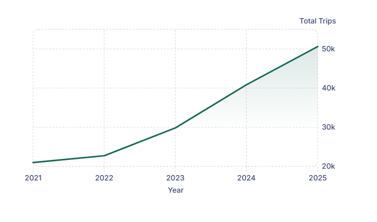
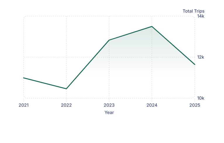
Trips in 2025 are nearly 2.5 times higher than in 2021, showing strong community demand for safer and more connected active transport options.
Strava Metro data confirms strong and growing participation in active transport across the Central Coast.
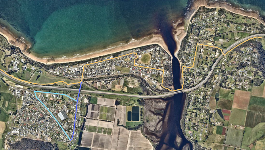
Image 1 of 2
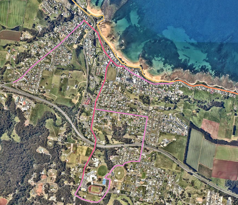
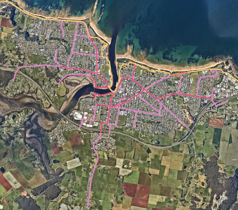
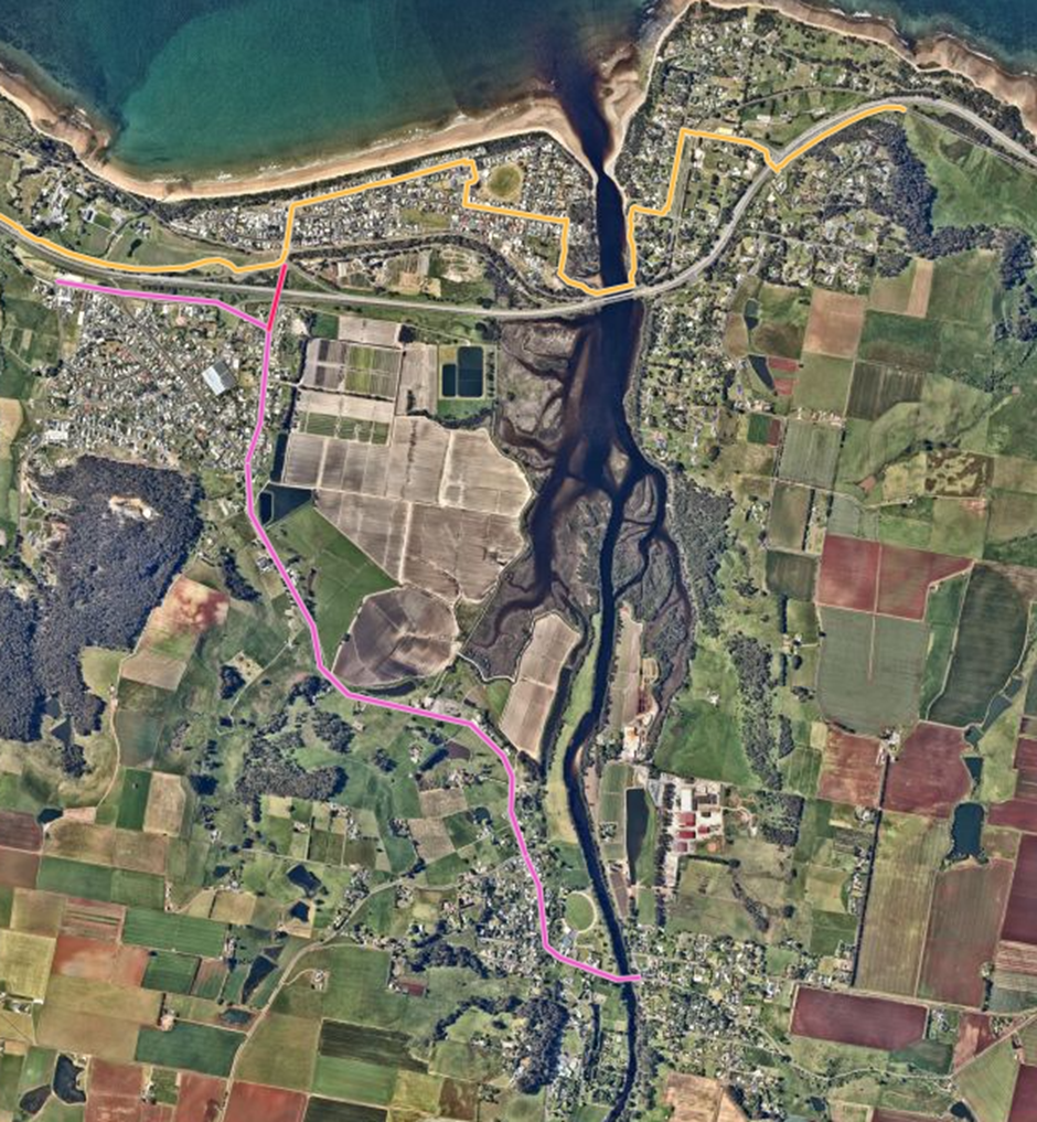
The network is structured around a clear hierarchy — from the regional Coastal Pathway spine to local neighbourhood streets.
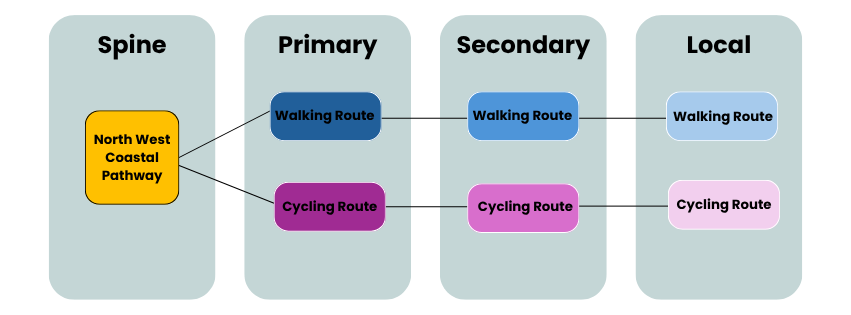
Spine: North West Coastal Pathway: the primary regional off-road corridor for walking and cycling
Primary Routes: High-priority corridors linking major destinations with protected cycling and wide footpaths.
Secondary Routes: Neighbourhood links to parks, schools and community facilities feeding the primary network.
Local Routes: Fine-grain access within neighbourhoods via low-speed streets and standard footpaths.
Central Coast has many footpaths in its coastal towns, helping people walk to local destinations. However, some areas have missing links, uneven surfaces, narrow paths or footpaths on only one side of the road, which can make access harder for older people, people with disability, families with prams and people using mobility aids.
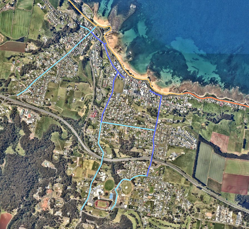
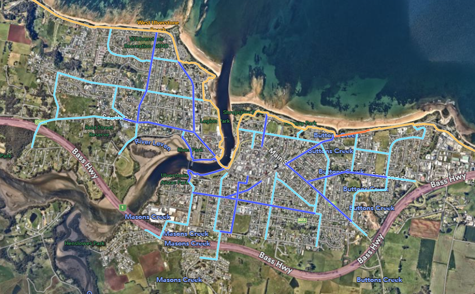
Cycling in Central Coast mostly happens on footpaths, shared paths like the Coastal Pathway, or on roads. There are currently no dedicated cycleways or bike lanes, which can make cycling uncomfortable for both riders and motorists.
![]()
| Phone | 03 6429 8900 |
|---|---|
| admin@centralcoast.tas.gov.au | |
| Website | www.centralcoast.tas.gov.au/ |
Central Coast Council acknowledges and pays respect to the traditional owners of lutruwita (Tasmania), the palawa-pakana people. We acknowledge the Punnilerpanner tribe of this Northern Country, and in doing so, we celebrate one of the world’s oldest continuous cultures.